Published by: Mandira
Published date: 25 Jan 2022

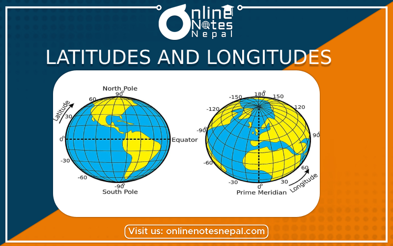
We can see several horizontal and vertical lines drawn on the globe and map. These lines are the imaginary lines. They are also called Latitudes and Longitudes. These imaginary lines are used for locating places and country on the map of the world.
Latitudes
Latitude is defined as an equatorial reference plane. This plane passes through the center of the sphere, and also contains the great circle representing the equator. Latitudes are also known as the imaginary lines drawn parallel to the equator from the east and west. Latitudes are the angular distance of the north place or south of the equator. The latitude has the symbol of phi, and it shows the angle between the straight line in the certain point and the equatorial plane. The latitude is specified by degrees, starting from 0° and ending up with 90° to both sides of the equator. It makes latitude of Northern and Southern. The equator is the line with 0° latitude.
The Equator is an imaginary line drawn in the middle of the Earth from east to west. It divides the earth into two equal halves. The equator is the line with 0° latitude. There are 90o latitudes in the north of the equator. They are called north latitudes. There are 90o latitudes in the south of the equator called South latitudes. Similarly, the latitudes of 90oare just a point. They are called North pole and South pole in the Northern and Southern hemisphere respectively.
Latitudes are expressed in degree, minute and second.
The five important latitudes are:
Longitudes
The longitude has the symbol of lambda and is another angular coordinate defining the position of a point on a surface of the earth. The longitude is defined as an angle pointing west or east from the Greenwich Meridian, which is taken as the Prime Meridian. The longitude can be defined maximum as 180° east from the Prime Meridian and 180° west from the Prime Meridian. 0o longitude is called Prime Meridian. It passes through the Greenwich in London. Prime Meridian divides the earth into two equal parts. The part east of the meridian is called Eastern Hemisphere and west of the meridian is called Western Hemisphere. Longitudes are the vertical and semicircle lines. All the lines of longitudes meet at the two poles of the earth.
Both latitude and longitude are measured in degrees, which are in turn divided into minutes and seconds. For example, the tropical zone which is located to the south and to the north from the Equator is determined by the limits of 23°26'13.7'' S and 23°26'13.7'' N. Or. For example, the latitude of Nepal is 26O 22' N to 30O 27' and the longitude is 80O 4' to 88O 12' E.