
Published by: Mandira
Published date: 18 Jan 2022
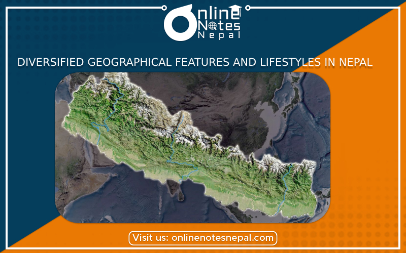
Nepal has wonderful variation in its landform and climate conditions. Owing to such variation Nepal also possesses a diverse type of natural vegetation ranging from the sub-tropical evergreen forest of the Terai belt to the pine forest, mountain grassland and tundra type of Himalayan Region. This means Nepal has varied climate and vegetation as its landform conditions. Nepal's climate is highly influenced by monsoon.
The Terai Region is leveled alluvial plain. It has easier facilities of irrigation so people there are involved in the cultivation of tropical and subtropical crops like paddy, mustard, tobacco and sugarcane. Due to hot climate, as many as three crops a year are possible. Large-scale industries like sugar factories, cigarette factories provide a good market for the agricultural products. When monsoon rain is timely, an agricultural yield is high. When it is not reliable or excessive farmers suffer drought or flood and landslide in the Terai and the hills.Agriculture is possible on the terraces of the hills slopes of the central belt of Nepal due to adequate monsoon rain it receives n summer. Its collar climate situations are favorable for the cultivation of varieties of crops including types of fruits like the citrus ones. Grass obtained from hillsides, community forests, and marginal land support some animal husbandry.
The Himalayan Region has harsh climates and difficult land topography. The surface is steep and soil is rocky and infertile. Very little area (only about 4%) is under cultivation. When it is possible crops like buckwheat, potato and fruits, mainly apple are cultivated. Only one crop a year is possible due to very cold climate. Animal husbandry is a popular economic activity due to extensive pasture lands available there. Houses are small and are made up of locally available stones and mud. Buckwheat and millet dhindo and potato are a stapled diets. People wear very warm clothes made up of wool locally available from the sheep and goats. Owing to cold climate conditions, their food also comprises alcohol.
Facilities of transport and communications are highly extended in the Terai Region, as the land topography, there is leveled and comfortable. Large-scale industries are well-distributed. Non-agricultural jobs like those in trade, business and service are also possible. The hilly region has less extended facilities and job opportunities due to its more comfortable hilly structure than that of the Himalayan Region. Socio-economic conditions are most difficult in the Himalayan Region. Development infrastructure has not reached most places. But high mountains with very cold and snowy conditions have attracted people from throughout the world for mountaineering which has bought several job opportunities to the people of this region.
It is so difficult to show the actual shape and size of an object on a page of the paper. So, it should be shown using the scale. Obviously, this helps greatly to find out the actual shape and size of an object. In the map, one metre can be represented by one centimetre.
The scale can be expressed in three different ways :-
Statement scale
It is also called verbal scale. It is the method of expressing the ratio of length on paper and on the surface in words. For example'one inch equals to one hundred and sixty miles.
Representative scale
The fractional method for portraying the scale of a map uses a representative fraction to describe the ratio between the map, and the real world. For example - 1:50,000 or 1/50,000. It means 1 unit of distance on the map means 50,000 of the same unit of distance in the real world.
Graphical scale
It depicts scale using a line with separation mark by smaller intersection lines, smaller to a ruler.
The above given map show asmall portion of Pokhara valley. There are the places of Pokhara and Palpa area. If we use the greater scale and observe closely scale than this, we can show Ranimahal. We need to use the suitable scale depending upon the necessity. There is a specific objective of drawing a map that determinesa map that determines the type of scale to be used