
Published by: Mandira
Published date: 17 Jan 2022
Nepal is a small landlocked country lying in the lap of the Himalayas, the world's highest mountain ranges. About 75% of its area is mountainous. Still the topography is quite uneven. Within a surface distance of hardly 200 km, the altitude ranges from about 60 m from the sea level to the highest summit of the world, i.e Mount Everest.
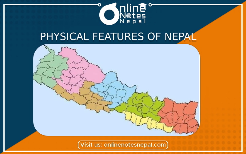
On the basis of geographical features, Nepal in divided into three distinct regions which run east-west across the country.
The Himalayan region comprises the highest areas of Nepal above an altitude of 3300 m from the sea level among the northern belt of the country. Many of the highest peaks in the world above 8000 m, including Mt.Everest, the highest of all, lie in this region. Kanchanjunhga, Makalu, Lhotse, Choyu, Dhaulagiri and Annapurna are some other high Himalayan peaks.
The surface is very steep, rocky and infertile. The climate is very cold and snowy. High peaks above 5000 m above are always covered by ice. Mustang, Manang, etc lying beyond the high mountains are rain shadows areas. This means they remain dry due to their locations on the leeward side of the mountains. There is mountain vegetation ranging from extensive pine forest to poor tundra type according to heights. This region occupies altogether 16 districts like Humla, Dolpa, Rasuwa, Solukhumbu, Taplejung and covers about 15% of the total area of the country.
The hilly region is the widest band running east-west between the Himalayan Region in the north and the Terai Region in the south. Actually, the high mountains of the Himalayan Region are the successive growth of the hills in this region; the climate and land are both moderate there. Its altitude ranges from 600 to 3300 m from the sea level. Gentle hill slopes, river basins, wide valleys around here. They receive enough rain and are most arable. Pokhara receives the most rain in the whole country. Rivers and streams are many and soil erosion is common. Mainly deciduous type of forest is found in this region. The hilly region consists of about 68% of the total area of the country and altogether 39 districts.
The Terai Region:
The Terai Region comprises three narrower bands-the Terai, the Chure range and the Inner Terai, all running east-west in parallel along the southern part. The real Terai region is completely a flat plain along the border with India, the Chure is the undulating series of low course hilly while the Inner Terai is the low land between the Chure in the south and the Mahabharata hills in the north. The altitude of the Terai region thus ranges from 60 to 600 m from the sea level. Due to its low altitude, its climate is mostly hot. The west has most extreme temperature conditions and lower amount of rain due to its greater distance from the sea. Composed mainly of fertile alluvial soil and irrigated by large rivers and underground sources of water, this region has very high agricultural yields and is popularly known as the 'granary' of the whole country. This region occupies 20 districts which amount about 17% of the total territory of the country. Its sub-tropical evergreen forest is very dense and extensive.
Formation process
According to the geologists, there was geosynclinal sea in between Angraland (Middle Siberia) and Gandanaland (South India) during Tertiary at about 7 crore years ago. The sea was called Tethys sea. Geologists found sedimentary rocks at the bottom of the sea by the stone, sand, soil, twigs etc.
The rocks and sedimentary slowly stored and at the bottom of asea it came to the upper part of the earth and formed as a Mahabharat range. During the formation of Mahabharat, some landforms went down and some parts get up in the form of hills, plateaus, basin, and valley etc. At the end of the Tertiary period, another range formed called "Chure range". It is the another range formed by the natural process of the earth surface.
After a thousand years, slowly the hills and plateaus turn into a plain land and sea also started to fill by the some debris at the end of Pleistocene period which converts into plain terai. This is how the single country Nepal was formed.
Utilities
Due to the topographical variation, we can found the difference in the land area. So, here are some importances and natural benefits of the natural resources utilization.