
Published by: Nuru
Published date: 20 Jan 2022
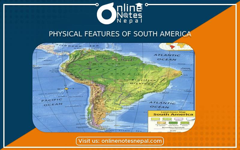
South America, the fourth-largest continent, extends from the Gulf of Darién in the northwest to the archipelago of Tierra del Fuego in the south. South America’s physical geography, environment and resources, and human geography can be considered separately.
South America can be divided into three physical regions: mountains and highlands, river basins, and coastal plains. Mountains and coastal plains generally run in a north-south direction, while highlands and river basins generally run in an east-west direction.
South America’s extreme geographic variation contributes to the continent’s large number of biomes. A biome is a community of animals and plants that spreads over an area with a relatively uniform climate.
Within a few hundred kilometers, South America’s coastal plains’ dry desert biome rises to the rugged alpine biome of the Andes mountains. One of the continent’s river basins (the Amazon) is defined by dense, tropical rain forest, while the other (Paraná) is made up of vast grasslands.
With an unparalleled number of plant and animal species, South America’s rich biodiversity is unique among the world’s continents.
South America’s primary mountain system, the Andes, is also the world’s longest. The range covers about 8,850 kilometers (5,500 miles). Situated on the far western edge of the continent, the Andes stretch from the southern tip to the northernmost coast of South America. There are hundreds of peaks more than 4,500 meters (15,000 feet) tall, many of which are volcanic.
The highest peak in the Andes, Aconcagua, stands at 6,962 meters (22,841 feet) and straddles the Argentina-Chile border. Aconcagua is the tallest mountain outside Asia.
High plateaus are also a feature of the Andes. The altiplano of Peru and Bolivia, for example, has an elevation of about 3,700 meters (12,300 feet). The Patagonia region of Argentina and Chile consists of lower-elevation plateaus and rugged glaciers.
Most plants in the alpine biome are small, and their leaves are stiff and strong to protect them from frost and drought. The largest herb in the world, Puya raimondii, is known as the Queen of the Andes. A Puya raimondii can live for 100 years and can grow to more than 9 meters (30 feet) tall. The leaves of this endangered species all grow from one woody stem, allowing moisture to run down the leaves to the base of the plant.
Outside the Andes, South America has two principal highland areas: the Brazilian Highlands and the Guiana Highlands. Located south of the Amazon River in Brazil, the Brazilian Highlands are made up of low mountains and plateaus that rise to an average elevation of 1,006 meters (3,300 feet). The Guiana Highlands are located between the Amazon and Orinoco Rivers. The heavily forested plateau of the Guiana Highlands covers southern Venezuela, French Guiana, Guyana, northern Brazil, and a portion of southeastern Colombia.
South America has three important river basins: the Amazon, Orinoco, and Paraguay/Paraná.
The Amazon River basin has an area of almost 7 million square kilometers (2.7 million square miles), making it the largest watershed in the world. The basin, which covers most of northern South America, is fed by tributaries from the glaciers of the Andes. Every second, the Amazon River empties 209,000 cubic meters (7,381,000 cubic feet) of fresh water into the Atlantic Ocean.
The Amazon River is the life force of the equally vast Amazon rain forest, which makes up about half of the rainforest of the entire planet. This tropical biome has as many as 100 different tree species on a single acre, including the rubber tree, silk cotton tree, and Brazil nut tree. Other important plant species include palms, ferns, and ropelike vines known as lianas that network throughout the rain forest’s dense canopy.
The diversity of animal life in the Amazon rain forest is unsurpassed in the rest of the world. The rain forest is perfectly suited for arboreal, or tree-living, animals. More than 2 million species of insects are native to the region, including hundreds of spiders and butterflies. Primates are abundant—howler monkeys, spider monkeys, and capuchin monkeys—along with sloths, snakes, and iguanas. Thousands of native birds include brightly colored macaws, parrots, toucans, and parakeets.
The Orinoco River flows north of the Amazon. The Orinoco flows in a giant arc for more than 2,736 kilometers (1,700 miles), originating in the Guiana Highlands of northern Brazil and discharging in the Atlantic Ocean in Venezuela. The Orinoco River basin covers an area of about 948,000 square kilometers (366,000 square miles) and encompasses approximately 80 percent of Venezuela and 25 percent of Colombia.
A vast savanna or grassland region, known as the Llanos, is the primary biome of the Orinoco River basin. The Llanos is primarily made up of grasses. Swamp grasses, sedges, and bunchgrass are found in wet, low-lying areas. Carpet grass is found in the higher and drier elevations.
Like most grassland biomes, the Llanos is the perfect habitat for many bird species, including the scarlet ibis, bellbird, and umbrellabird. Important river species include the piranha, electric eel, and the Orinoco crocodile, which can reach a length of more than 6 meters (20 feet).
The Paraguay/Paraná River basin covers almost 2.8 million square kilometers (1,081,000 square miles), which is much of southeastern Brazil and Bolivia, Paraguay, and northern Argentina. The Paraná River includes Iguazu Falls, a massive series of waterfalls that extend for 2.7 kilometers (1.7 miles).
Along with the Uruguay River, the Paraná River empties into the Rio de la Plata estuary between Argentina and Uruguay. The Rio de la Plata is the most populated region of both countries. The capital cities of Buenos Aires, Argentina, and Montevideo, Uruguay, practically face each other across the estuary.
The Paraguay/Paraná River basin supplies water to the plains biome, or Pampas, of South America. The Pampas have rich, fertile soil and predictable rainfall patterns. They are the most important grazing and cropland areas on the continent.
A coastal plain is an area of low, flat land next to a seacoast. South American coastal plains are found on the northeastern coast of Brazil, on the Atlantic Ocean, and the western, Pacific coast of Peru and Chile. The coastal plains of northeastern Brazil are extremely dry. The Brazilian Highlands act as a wedge that pushes moist sea winds away from the coastal plains.
The western coastal plains are also extremely dry. They are trapped between the cold Peru Current to the west and the Andes Mountains to the east. The Peru Current brings cold water to the Pacific coast of Peru and Chile. This cold surface water results in thermal inversion: cold air at sea level and stable, warmer air higher up. Thermal inversion produces a thick layer of clouds at low altitudes. These low-lying clouds blanket much of the Pacific coast of South America. They do not allow precipitation to form.
The Atacama Desert is part of the western coastal plain. The Atacama is considered the driest region in the world. The average rainfall is about 1 millimeter (0.04 inches) a year, and some parts of the Atacama have never had rain in recorded history.
Very few plants grow in this desert. Even bacteria, insects, and fungi are scarce. Larger animal species are also rare and include the grey fox, a type of deer called the huemul, and the viscacha—the largest member of the chinchilla family. Ocean birds, such as penguins, cormorants, and pelicans, are found on the desert coast. While the Atacama lacks flora and fauna, it is a rich source of copper and a chief source of revenue for the Chilean economy.